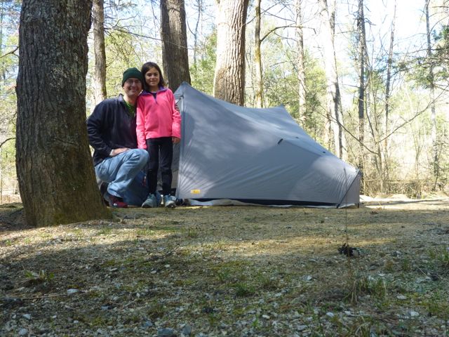
At the North Creek campground ready for a cold night (25F).
As part of the stepwise introduction to backpacking, I took Kaylee out to the mountains for our first daddy-daughter mountain hike. I picked Apple Orchard Falls because it's a nice loop, with a significant climb (~2000 feet up, then down), plus you follow a creek up and down so it's interesting both ways. I'm also familiar with the trail since the Promise Land 50K race utilizes both trails and I've run it and a few training runs on the course multiple times. With Spring being late this year things weren't green (at all) so it wasn't as pretty as it could be. On the plus side there were no/fewer ticks and no stinging nettles.
We camped Tuesday night at the North Creek campground in the Jefferson National Forest near Buchanan, VA. It's a "primitive" site that has some pit toilets (very clean!), a few public water pumps and no electricity.
The sites are mostly all along North Creek so you have a nice babbling background to listen to. Each site had a nice sandy area for tents, a metal fire pit, and a picnic table, all for $10 a night. All the sites were spotless.
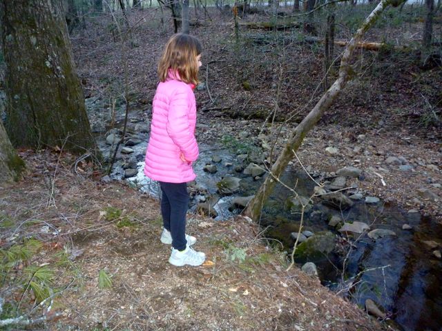
We walked up the White Tail Deer Trail a bit the first evening, and spent some time walking along North Creek. For you fishermen out there the creek is stocked with rainbow trout (in addition to native brook and rainbow trout) and open year-round so we saw a few folks fishing. Just up from the campground it's designated as catch and release only, but from the campground downstream you can keep what you catch (within limits).
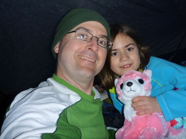
As evening grew the wind picked up and brought in the cold. We wriggled into our bags around 7:30 or so and read in the tent before bed. Temps got down to about 25 F that night.
The new tent (Stratospire 2 for those wondering) worked great. There was some iced condensation on one side from our breath but the interior was bone dry. The air was still chilly and it was hard to get up and going.
Eventually we got up, made a small fire to warm up, boiled some water for oatmeal and hot chocolate, packed up everything, and drove up the road 2 miles to the trail head. (I was going to walk there but I'm glad I didn't. I thought it was only half a mile, not a full 2 miles.)
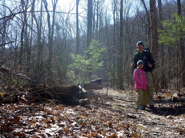
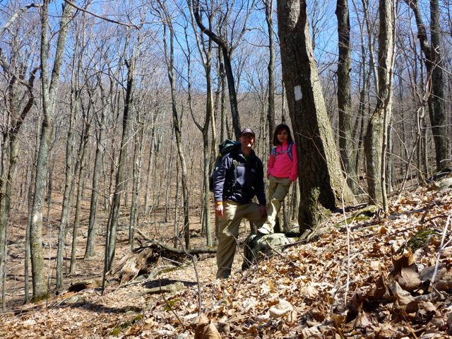
We began our ascent up Apple Orchard Falls Trail around 10:45. The sun was up and it was getting a bit warmer. I wore a full pack (tent, bag, pad, stove, fuel, food, 2L of water, first aid, etc. I'd guess about 25 lbs) and Kaylee wore her hydration vest with a liter of water.
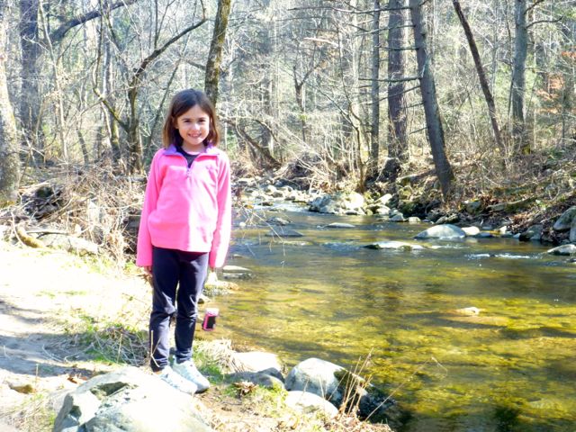
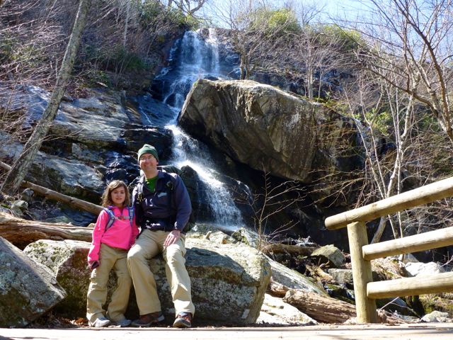
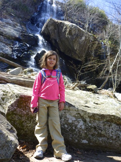
The hike starts out pretty easy and gets progressively steeper as you get closer to the main attraction: Apple Orchard Falls. It's about 2 miles from the lower trail head to the falls and we made it in about 2 hours. We stopped for lunch and enjoyed the falls.
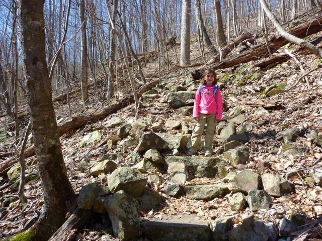
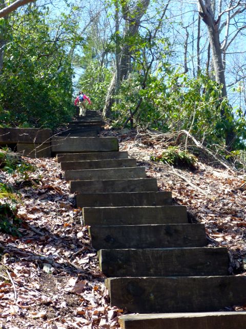
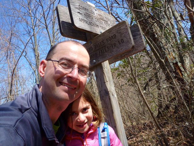
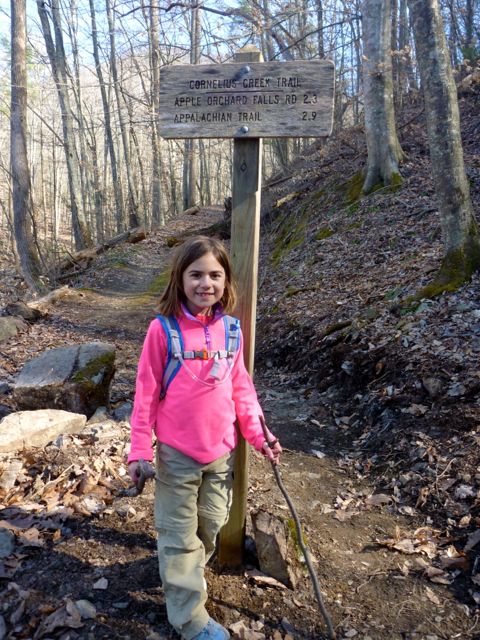
We moved on upward another mile and a half to the intersection with the Appalachian Trail. There's a lower connecting trail/road that heads to Cornelius Creek but we wanted to have the AT credentials. There are quite a lot of steps here; 160 or more in total if you keep counting.
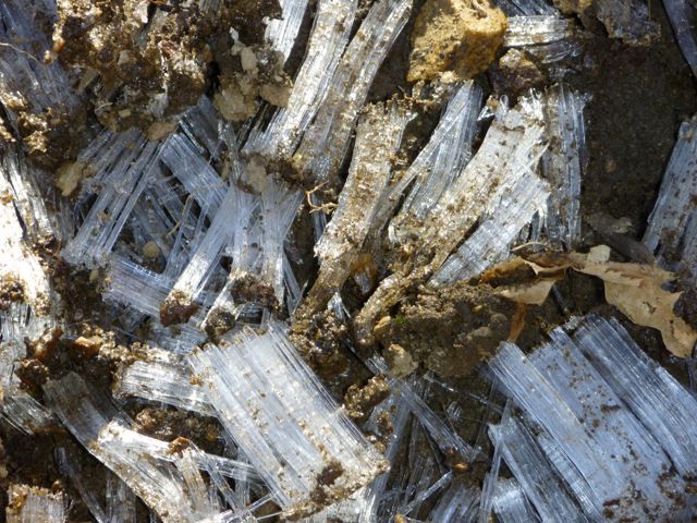
The ground was often frozen through here and we saw some interesting "ice grass". It looks like it had formed around actual grasses but that's just a guess. It varied from half an inch up to 2 inches tall.
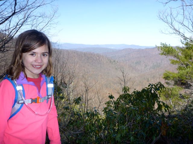
Kaylee and I discussed climbing the extra 0.3 miles to Sunset Fields (a parking log on the Blue Ridge Parkway at the top) but given the growing lateness of the day and the fact that we still had 4 miles to go I decided against it. It was during this part of the climb that we saw a couple hiking down with their dog. They were the only folks we saw on the trail.
The AT section was a bit longer than I remembered and our own "down" point. Kaylee took a little tumble one of the many rocks on the trail. She wasn't hurt but a little unnerved. We took a brief break then moved along, finally reaching the Cornelius Creek connecting trail (after about 1.2 miles on the AT).
We made good time moving downhill on Cornelius Creek trail. There's a nice section there where you're walking through green tunnels of Mountain Laural that are probably very nice when they're in bloom.
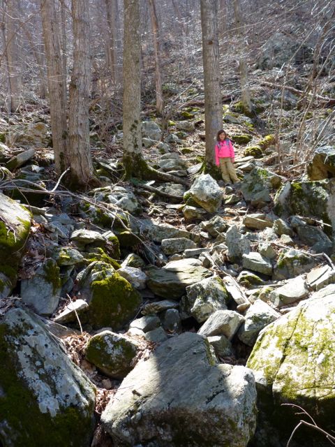
We hit the intersection with the previous connector trail we didn't use and took another short break before beginning the last 2 mile section downhill. This section of the trail has quite a steep descent through a bit of rock garden which makes things challenging. When you finally hit the creek a bit later it's a lot easier. (Note there's a pretty good looking camping site right there as the trail approaches the creek.)
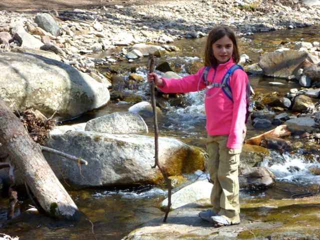
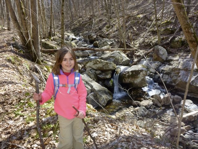
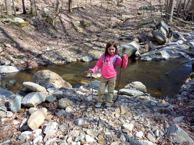
I think Cornelius Creek is actually prettier than Apple Orchard Creek. It doesn't have any big falls but does have nearly continuous cascades and pools. There are three "big" creek crossings. We rock-hopped over the first. The second had a bridge, and the third was an adventure.
The rocks were sufficiently far apart that I wasn't sure Kaylee could safely jump to them (and she agreed). We tried a few different approaches up and down stream but finally ended up with me picking her up and carrying her across as I waded through the shin deep mountain stream. It wasn't as cold as I was expecting.
From there it's about a mile back to the trail head/car. (Cornelius Creek Trail and Apple Orchard Trail end in the same place so it's very convenient.) In total the hike was about 7.5 miles and took about 5.5 hours. We finished up around 4:30pm.
We drove the 2 miles back to the campsite (glad we didn't have to walk) and Kaylee suggested naps. Naps it is! We got up at 6:30 to make dinner, enjoy another camp fire, check out the creek some more, then head to bed. The second night didn't feel as cold to me but was still below freezing. We were definitely glad to have the newer sleeping bags (15F/20F rated).
We both had a great time. Kaylee did an amazing job on a very challenging hike. Those climbs are no joke. She powered through them like a pro. A summer visit may be in order to enjoy some of the "swimming holes" along the way.