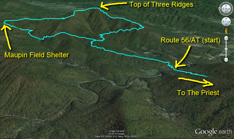
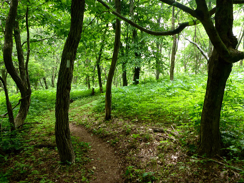
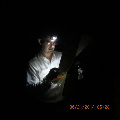
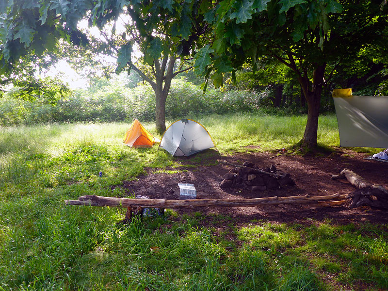
Beginning of Saturday for the group (Route 56 to Route 56 on the Three Ridges/Mau-Har trail loop).
- Dave MacLuskie
I've been getting a bit bolder with my backpacking trips as I regain some experience. The DC UL Meetup group that I joined last fall has been a great way to meet folks with similar desires, endurance, and often greater skills than I have. They have some silly notations for specific "feats". One of them is the number of consecutive 20 mile days on a trip. A user may have a (3) by their name indicating successful completion of a single trip with 3 consecutive 20+ mile days. Another one is distance related. A (!) indicates a 30+ mile day. [Note: programmers call the exclamation point a "bang". Apparently 1950's secretaries did too. I'm not sure why.] I didn't have a bang (!) yet and I wanted one. I've done multiple ultras that long so backpacking it didn't seem odd at all.
I didn't want it to be easy though. I wanted something that would be a challenge; in the realm of possible, but a challenge. Hence the idea of the Improbable Thirty. I set up a route that would be possible but difficult. In addition to being over 30 miles it would involve a lot of elevation gain (over 10,000 feet gain) and some of the tougher climbs on the Appalachian Trail (AT) in Virginia. It would allow folks to push their limits and be a real challenge. After all you don't know your limit until you fail. Of course, on the more material side the folks that signed up probably wanted our thirty mile bang (!). Four of us ended up going: me (EZBake), John (The Look), Karan (B.A.), and Hua (Wawa). [The name in parenthesis is our "trail name" which we may or may not be called on the trail. It's kinda an earned nickname and usually has a good story behind it. It's a backpacker thing.]
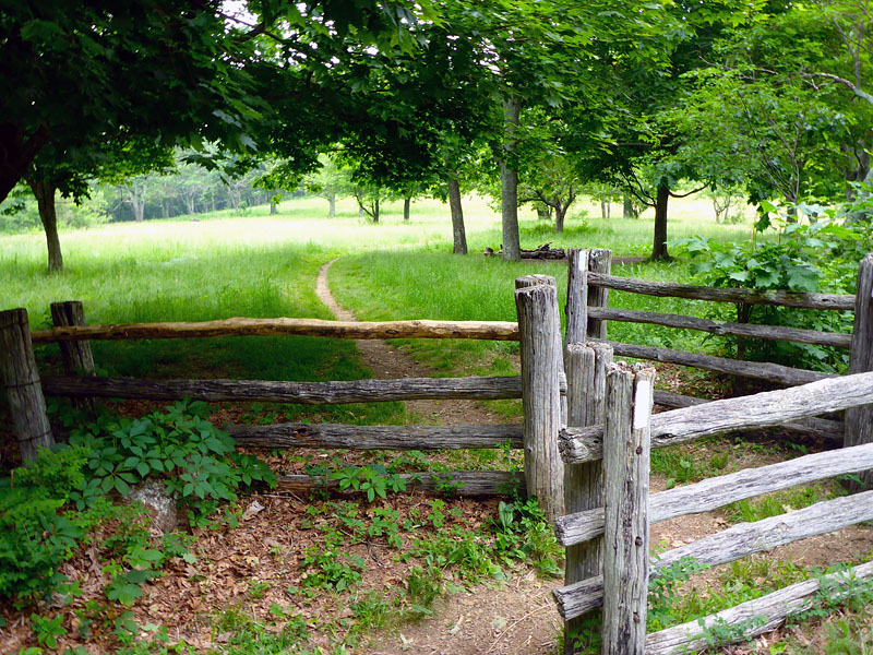
The group was going to meet up Friday night after work at the AT crossing along Route 56. We'd camp right there along the Tye River and get started in the morning. In order to eliminate shuttling cars back and forth and get in a few extra miles I departed early on Friday and drove to the "finish" at Hog Camp Gap. It's a nice flat spot on top of a mountain with parking right next to the AT. It's also the trail head for the Mount Pleasant hike that Kaylee and I did last fall. I parked my car and at 10:30am started the 18-20 mile hike to our official "start" along Route 56. The section of the AT is along Tar Jacket Ridge. I haven't hike it before and found it very serene. The views along the ridge were blocked by all the leaves but the ample shade was welcome.
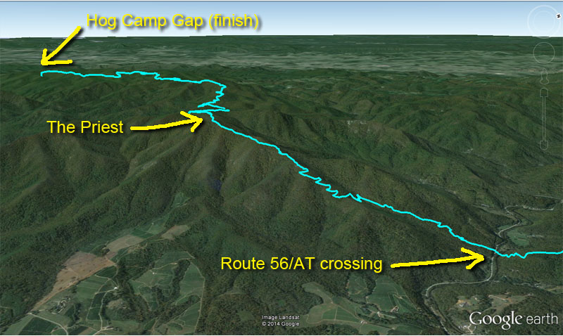
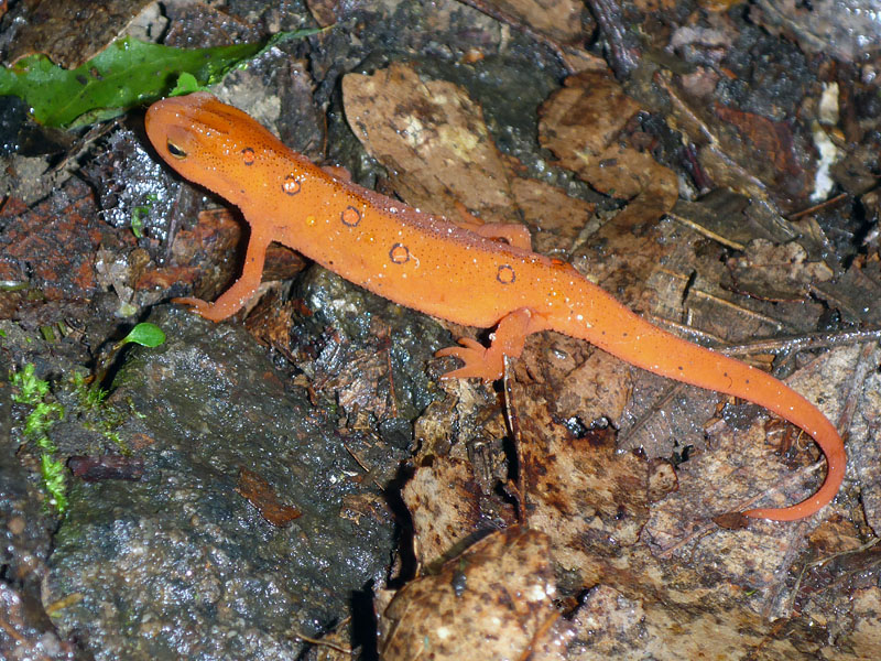
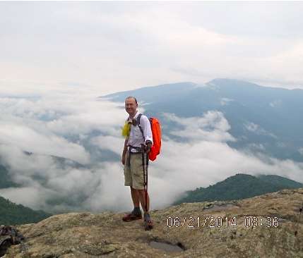
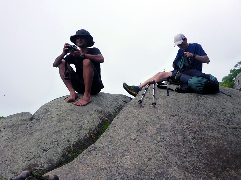
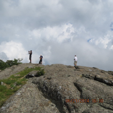
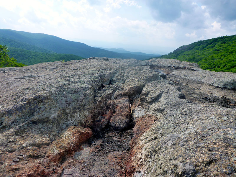
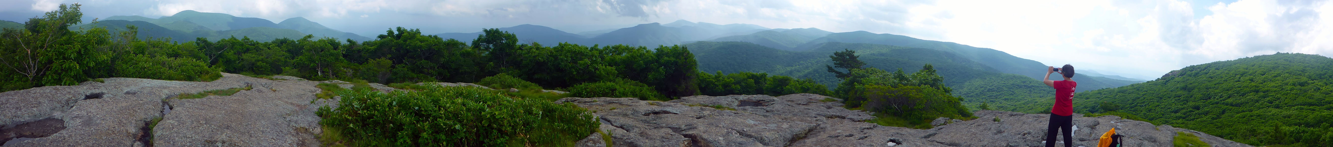
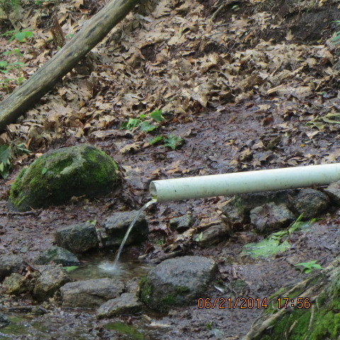
I passed by one of the many AT shelters and refilled my water from a mountain spring. I climbed up for some of the views from Spy Rock - a large rock with 360 degree views of the surroundings -- were mostly clouded in. My only delay was a minor thunderstorm while I was at the very tippy top of The Priest at 4000 feet. I high tailed it off the mountain as fast as I could. The upside was getting to see all the red efts that appeared with the rain. The overall route was generally downhill so I made good time, arriving at the parking lot on Route 56 at 6pm.
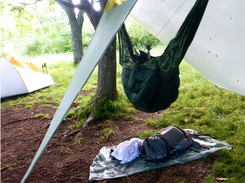
John arrived promptly at 7pm and we strolled across the suspension bridge to set up camp along the Tye river. I made myself dinner while we chatted. The skies darkened and a severe thunderstorm rolled in around 8:45pm. The wind was strong, rain heavy, and lightning close by. Despite pitching my hammock tarp low, rain was blowing horizontally nearly all the way through beneath it. Fortunately only the ground got wet and I was quite dry hanging between the trees. I'm quite pleased with how well that worked out. I hadn't used this setup in anything but clear conditions before.
Karan and Hua arrived some time after 9pm after the worst had passed. Karan reported some impressively scary lightning displays as they drive down Route 56. I was already drifting off but muttered a hello and relayed my desire to start hiking at 6am. The group talked me down to 5:30am and I agreed.
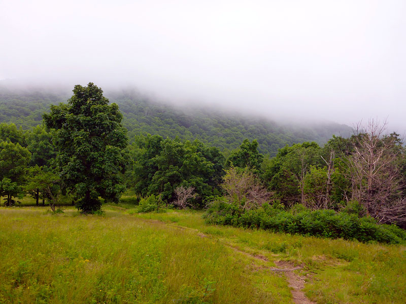
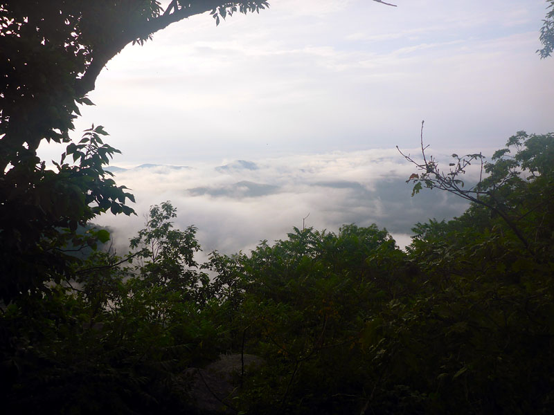
The morning of summer solstice was dry but humid. We basically woke up in a cloud. The previously predicted "all day rain" never materialized. In fact the weather was better than we could have hoped for mid-late June. I'm fairly certain it never reached the 80's. After a brief review of our route on the map we started the long climb up the Three Ridges. The water in Harpers Creek was noticeably lower than it was in April. There was a dozen or so tents near the Harpers Creek shelter and folks just rising. We reached the top of Three Ridges, wiped the ample sweat from our faces, and enjoyed views of awesome cloud filled valleys before descending to the Maupin Field Shelter. There were dozens of tents there as well and folks starting to pack up. Wawa and Karan continued on while John and I tanked up on water by the shelter.
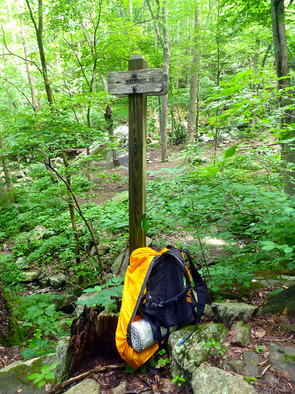
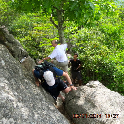
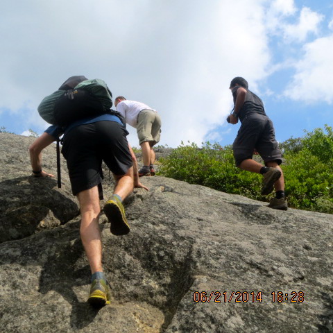
The descent down the Mau-Har trail was slippery from the recent rain. Karan, as per usual, blazed through like it was nothing. I landed on my butt at least three times. After a brief stop to see the waterfall we continued on to the AT, sweating away most of the water we had consumed.
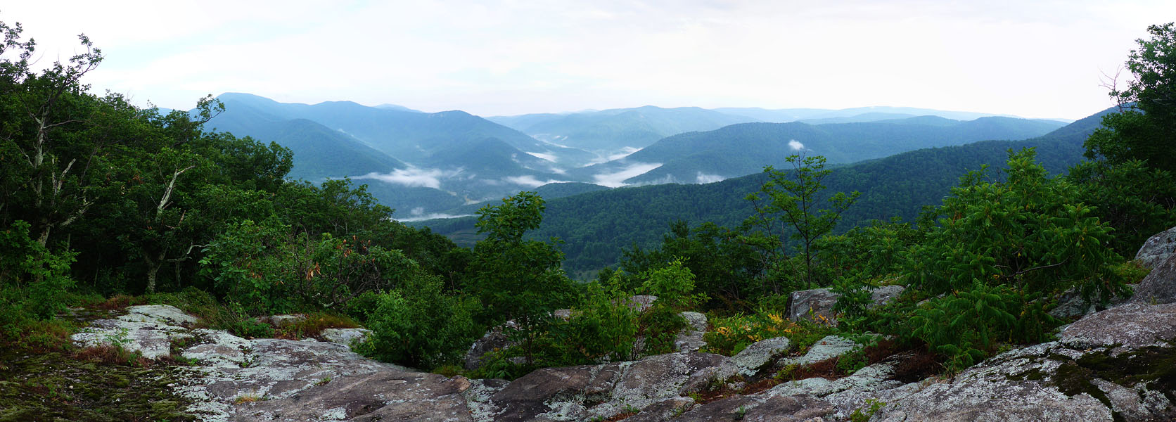
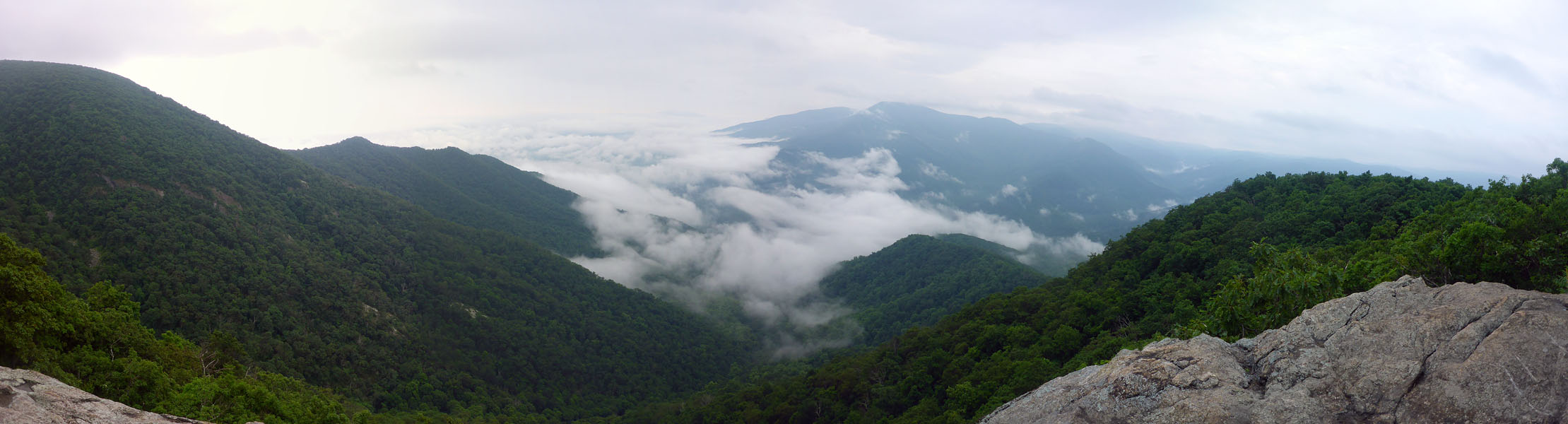
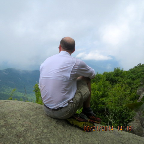
The descent back to the Route 56 was almost relaxing. We arrived around 11:45am, crossed the suspension bridge over the Tye River and began the long 3000 foot climb up The Priest. Karan and John soon disappeared. I really struggled in this section. I noticed the signs of low blood sugar (fatigue, crankiness, etc.) but was determined to reach the top before I took a break (another sign of low blood sugar: bad decision making). In the end one step at a time wins the day. We all gathered at the top of the Priest and enjoyed on and off views through the clouds from the overlook. Three naked thru-hikers with make-shift loin cloths joined us though were courteous enough to enjoy the view from a rock further along. We all got a good laugh. (It was officially naked hiker day.)
We made a stop at the Priest shelter where we tanked up on water and listened to the chatter of a troop of Boy Scouts. I wonder if they met the naked hikers. The trail would be dry along the ridge until we reached the Seely/Woodworth Shelter about 7 miles away. With the hard part of the trip over and a bit more than half the miles under our belt we departed the Priest shelter around 2:30 pm. Wawa tore off down the hill and the rest of us strolled after her.
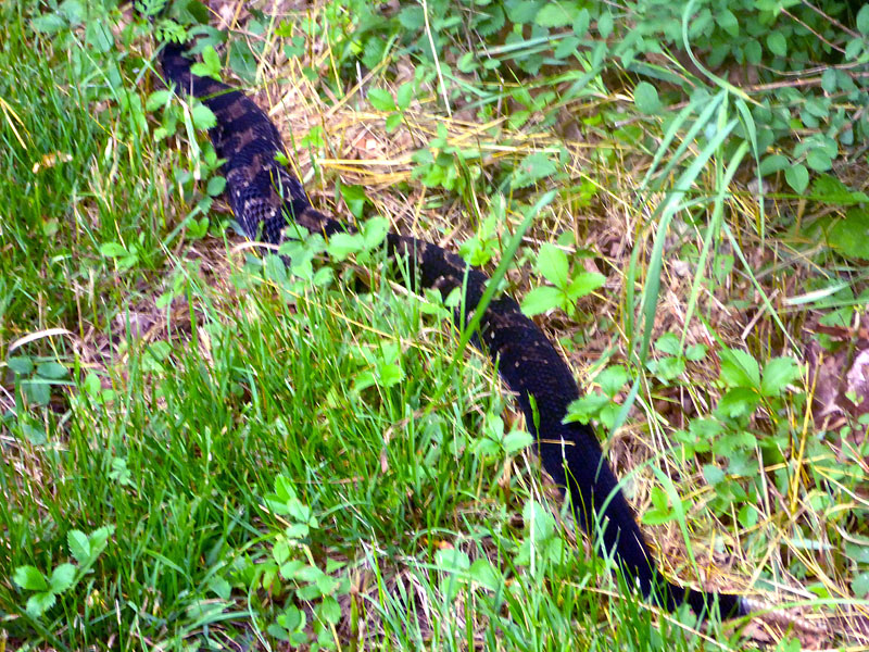
Just as we crossed the gravel road to Crabtree Falls Wawa yelled that she saw a snake.
"What color?" we yelled back.
"Black!"
"Good!" I yelled. "There are no poisonous black snakes in Virginia!"
"It's not ALL black!" Uh oh.
By then we had arrived to see Wawa all together too close to a fully elongated black/brown rattle snake with a fair number of rattles laying alongside the trail. John made a note to compile a photo flip book of poisons critters for folks. Wawa moved safely on and the rest of us stomped about (at a safe distance) until the snake reluctantly moved off into the woods rattling it's tale aggressively. I made a note to reassess my overly-generalized "black snake" policy.
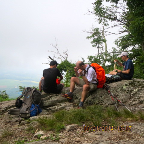
The rest of the group hadn't seen Spy Rock yet and it's far too cool a place to pass up so we stopped and scrambled up to enjoy the 360 degree views. Fortunately it was mostly cloud free and sunny with a nice breeze (and distant thunder). We enjoyed a well earned snack and break before scrambling back down to continue on to the Seely/Woodworth Shelter for more water.
This section of trail is lovely and well graded and we were flying along. The piped spring at the shelter was running like a faucet and we tanked up quickly. Wawa, in typical fashion, moved on before us. I had tracked the distance to/from Hog Camp Gap at about 7.8 miles on Friday but was unsure of the accuracy. John and Karan felt the map indicated it was closer to 6 miles. (You should be sensing some foreshadowing here). I left with full water bottles as John and Karan finished up. It took a solid 45 minutes to catch Wawa and I was cruising at about 3 mph. John and Karan passed us shortly there after.
After about 4 miles, around 7:20pm, we passed a sign that said "Salt Log Gap" 1.7 miles. Hog Camp Gap is another 2 miles further on from that. It turns out my original 7.8 mile estimate was fairly accurate. I think that was a bit of a mental blow to everyone. We arrived at Salt Log Gap right at 8pm and took a short break to reassess. We just clicked to 30.0 miles by my conservative GPS. Karan's feet were a bit tender with a forming blister and he performed a bit of foot care. The group consensus was carry on the 2.2 miles to Hog Camp Gap and camp there for the night. The original plan was to go to Hog Camp Gap then climb the 3 miles up Mount Pleasant for the sunset. We'd be too late to catch any views from Mount Pleasant at this point and we'd still be well over 30 miles.
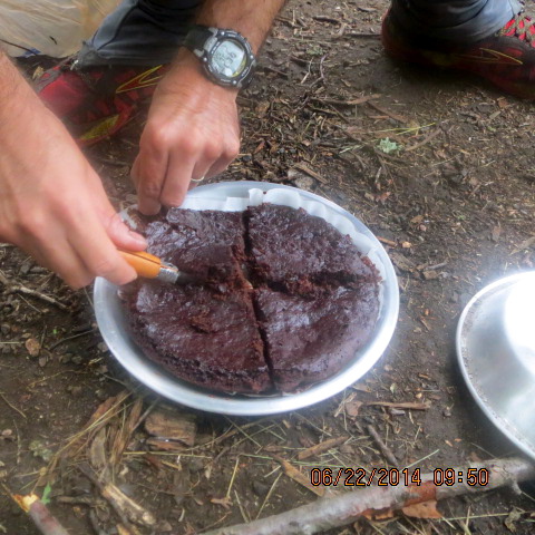
This section was a bit of a blur. John took off like a rocket and I tagged behind. We startled a wild turkey and a couple deer. Finally we were up and over the last rise and a quick descent to the large field, arriving at 8:55pm with enough light to bask in our glory. Wawa and Karan arrived before I could even drop my poles. To my amazement the entire camp was deserted. It's usually a pretty popular spot. My car was still the only one in the lot. We were soon setting up camp in the after glow of the setting sun. I had put a few cans of beer in a cooler in my car and it was still cold so we each had a brew while we made dinner and listed to some coyotes in the distance. We were too tired to setup a fire and enjoy my special cake baking that night so we rescheduled Devil's Food cake for breakfast (never a bad idea). It rained a bit around midnight but I don't remember much else.
But the adventure wasn't over! The general plan was to sleep in and bake the cake for breakfast before a 10am departure. John was up and eager to move at 6:30am. I was in one my more awake stages at the time and he ran his plan by me: a solo hike of the 5-6 mile Mount Pleasant loop. Excellent! Have fun! Karan snored his approval. Wawa was up by 7:15am and unfortunately I was not as lucid. I thought she indicated she was going on a "use the facilities" type jaunt. I was wrong.
Karan and I were on our feet by 8am and a bit concerned about Wawa. We collected some firewood and got a fire going to bake breakfast cake. John rolled in at 9am reporting an enjoyable hike but limited views from Mount Pleasant. We sat about worrying about Wawa and figuring how far I'd get demoted. We recruited some south bound hikers to keep a lookout and direct her back our way if they saw her. Fortunately Wawa had her phone with her and responded to Karan's text message. It turns out she had told me she was going to hike the AT out to Cold Mountain for a morning view and then came back. I had misunderstood her declaration at 7am. She pulled into camp 5 minutes later at 9:35am wondering why "two guys and her husband" (as reported by the south bound hikers) were asking about her. It's unclear to which one of the three of us was her "husband".
She was just in time for breakfast Devil's Food cake which we all enjoyed. Little things like that got me the trail name "EZBake". The drove back along the Blue Ridge Parkway which was mostly clouded in but we got a few peeks. After getting everyone back to their car we headed to Devil's Backbone brew pub to enjoy an excellent lunch. Karan declared the chicken wings so good he ordered a second meal to go.
Everyone earned their bang (!) this weekend. My GPS was tracking fewer miles than everyone else's and it claims 32 miles, 11K feet gain for Saturday. Based on those numbers our average moving pace was 2.6mph; average pace overall 2.2mph. My Friday numbers were about 20 miles, 4K elevation gain.
Wildlife tally: squirrels, chipmunks, turkey, deer, rattle snake, red efts, 4 naked thru-hikers, many clothed thru-hikers.
I wonder if I misnamed the Improbable Thirty. I suppose the only real failure was that nobody failed. No one exceeded their limits and most set new single-day distance records. The only thing that hit a limit this trip was my GPS. Apparently I exceeded the maximum data points for a single track log because I lost the first mile or two of Saturday. Fortunately that was within the out/back on the AT so I can recreate it.
I really enjoyed the weekend. The solitude of the 20 mile solo hike on Friday was very enjoyable. The company on the 32 mile hike on Saturday was every bit as enjoyable. I really like the challenge the terrain offers along this stretch. The views can be tremendous and are so different from season to season.
dave.macluskie AT gmail.com